Tuesday, April 26, 2011

Winterized Wisconsin Countryside


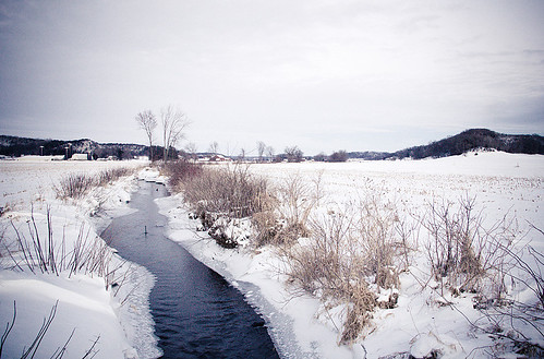
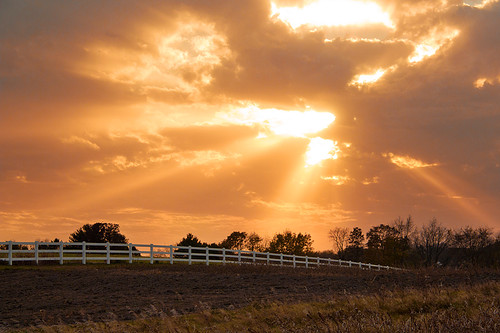
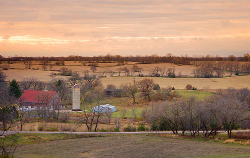
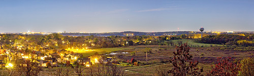
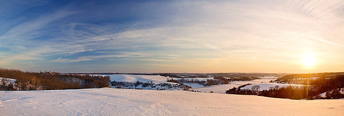
Sunset Countryside Panorama, originally uploaded by jw_creations.

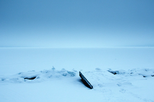
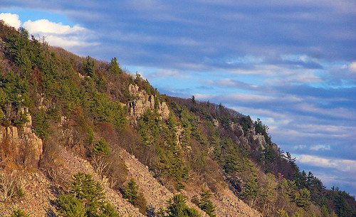
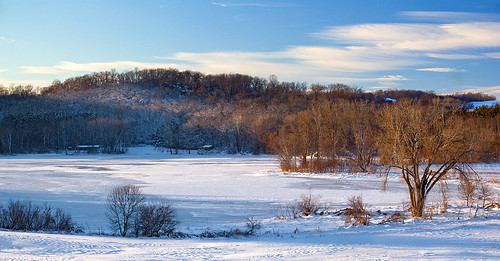
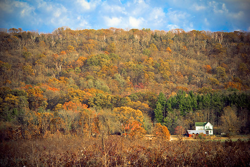
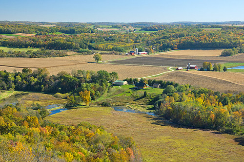
The snow covered, undulating terrain of Southern Wisconsin - carved by many millenia of erosion from what was once flat ocean bottom, many millions of years ago.


Black Earth Creek, originally uploaded by jw_creations.

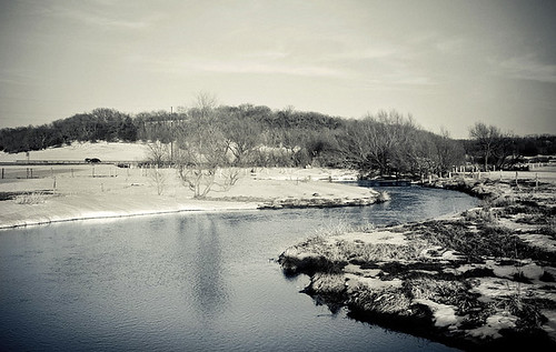
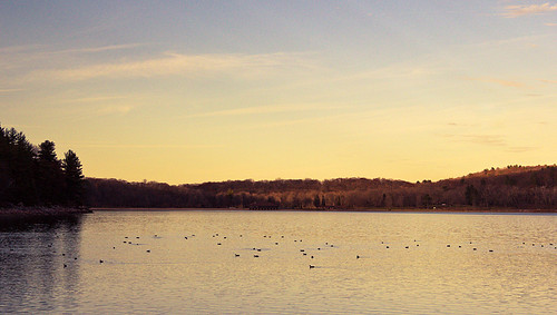
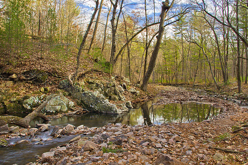
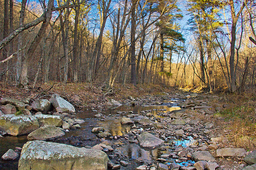
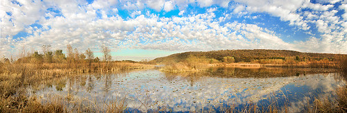
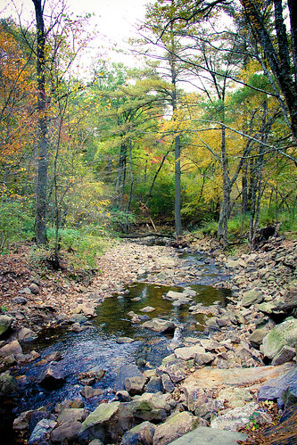
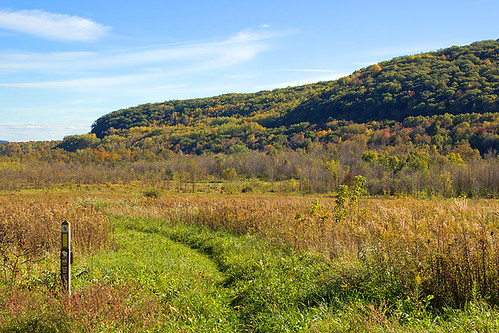
Flowing within an agricultural valley, the Black Earth Creek Fishery Area is considered a Class 1 trout stream, and is constantly managed for stream restoration, trout habitat, and public access.

Island Sandbars


Island Sandbars, originally uploaded by jw_creations.

Sandbars and floodplain forests along the lower Wisconsin River. Taken from Cactus Bluff, within the Ferry Bluff State Natural Area.

Tuesday, March 8, 2011

Winter Over Lake Monona


Winter Over Lake Monona, originally uploaded by jw_creations.


Wisconsin Capital, originally uploaded by jw_creations.

" Researchers at the University of Wisconsin-Madison have data recording the formation and melting of ice on Lakes Mendota and Monona in Madison since 1855. The timespan of this record makes it an invaluable resource for documenting the local impacts of long-term climate change.

The records show significant year-to-year variability in the length of the ice-cover season, but there is a clear trend of fewer ice-cover days over time. Overall, the average number of days of ice cover on the Madison lakes has decreased by around 29-35 days over the past 150 years. Significantly, the longest ice seasons on record are all clustered in the first few years of the record, while most of the shortest seasons fall towards the end of the record.

The impacts of reduced ice cover are ecologically significant for lakes and their aquatic species. Ice cover regulates lake temperatures, dissolved oxygen levels, light penetration, and many other ecological parameters that govern growth and reproduction of species and interspecies relationships. Because ice cover reduces wintertime evaporation, it helps to maintain a lake’s water level. A lack of ice cover means that winter winds can make contact with lake waters, disturbing fish nesting sites, and impacting the ways lakes stratify, or form layers of water ordered along a temperature gradient. No ice cover also means no snow cover, allowing sunlight to penetrate the water and increase its temperature. In turn, warmer water temperatures may make the Madison lakes more hospitable to non-native species. For example, University of Wisconsin lakes researcher Jim Kitchell has documented an increase in numbers of sea lampreys, an invasive pest and lake trout parasite, as Lake Superior’s waters warm." -ClimateWisconsin.org

Friday, January 7, 2011

The Best Way to Spend an Afternoon


The Best Way to Spend an Afternoon, originally uploaded by jw_creations.


Foraging Waterfowl, originally uploaded by jw_creations.


Remnant of Ancient Errosion, originally uploaded by jw_creations.

Devil's Lake State Park’s bluffs are part of the Baraboo Range, which scientists believe were formed 1.6 billion years ago, making them one of the most ancient rock outcrops in North America.

These ancient hills are formed of quartzite rock, which consists of grains of sand tightly cemented together. According to geologists, the sand was deposited by rivers as they drained into shallow seas covering this area a billion years ago. As the sand accumulated, it first formed sandstone (a porous sedimentary rock) and then, under great heat and pressure, became quartzite (a non-porous metamorphic rock).

Prior to the last Ice Age roughly 15,000 years ago, the ancient Wisconsin River flowed between these hills before being diverted to it's present location to the East by massive continental ice sheets. The resulting terminal moraines effectively dammed the river at the north and south ends, and formed the lake that resides here today.

Stillness at Baxters Hollow


Stillness at Baxters Hollow, originally uploaded by jw_creations.

In March of 1995, The Nature Conservancy designated the Baraboo hills as a “Last Great Place,” one of only 75 outstanding ecosystems in the western hemisphere and today as you know, we can explore this great place at one of Wisconsin’s most popular state parks, Devil’s Lake. However there are some smaller tucked away areas just perfect for those of us looking to avoid the crowds and really feel alone with nature. One little known area is just west of Devil’s Lake State Park and is known as Baxter’s Hollow.

Baxter’s Hollow is managed by the Nature Conservancy and is a dedicated State Natural area with one marginally maintained trail. This is not a public park as such, but a preserve. The trail is often muddy and is not meant for extensive public traffic. It is most often used by student groups studying the Wisconsin Environment.

Baxter’s Hollow is notable for the large area of deep forest and the mountain-like Otter creek within. At Baxter’s Hollow there are still moments when you can stand and listen to nothing but the breeze rolling through the hollow and the occasional songs of the native birds. Baxter’s Hollow is your best chance to bypass the summer tourists and explore the quiet natural wonder of our beautiful state.

Wisconsin Countryside


A Winters Flow, originally uploaded by jw_creations.

Encompassing more than 24,000 square miles in the states of Minnesota,
Wisconsin, Iowa and Illinois, the Driftless Area is one of America’s unique
natural resource treasures. Bypassed by the last continental glacier, which
flattened Midwestern landscapes and left behind large deposits of soil and rock—or
drift—the area was, as Ted Lesson aptly described it in his book Jerusalem Creek:
Journeys into Driftless Country, “an island of land rising from a sheet of continental ice.”

Wednesday, December 22, 2010

Moonlit Skiing at the UW Arboretum

A few time-lapse night photos taken after a moon-lit cross-country ski run through the University of Wisconsin Arboretum in early December.

Thursday, December 16, 2010

Rainforest Botanicals

A total of 40 to 75% of all species on the world's habitats are indigenous to the rainforests. It has been estimated that many millions of species of plants, insects, and microorganisms are still undiscovered. Tropical rainforests have been called the "jewels of the Earth", and the "world's largest pharmacy", because over one quarter of natural medicines have been discovered there. Rainforests are also responsible for 28% of the world's oxygen turn over, often misunderstood as oxygen production, processing it through photosynthesis from carbon dioxide and storing it as carbon through biosequestration.

Winter Sunset


Winter Sunset, originally uploaded by jw_creations.

Lakes freeze from the top down, because ice is less dense than water, which is why ice floats. The density of liquid water is determined by its temperature, and water is most dense at about 40 F.

Why is that important? As winter sets in, lakes lose energy to the atmosphere, and water near the surface cools, becomes more dense, and sinks. Warmer, less dense water under the surface will rise to replace this surface water. When the entire lake reaches 40 F, the surface water cools further, dropping below 40 F. Because this water is now less dense than the surrounding water, it will stay on the top and continue to cool.

Once the surface water falls to 32 F, it freezes. The freezing then spreads downward into the lake and the ice thickens. Unless the lake is very shallow, you will find liquid water below the ice. This deeper water is about 40 F; fortunately fish can live in this cold temperature.

Freezing first occurs along the shoreline, where the water is shallow. Before ice can form on the surface, the entire water column must first reach 40 F, which is likely to first occur along the shoreline.

Thursday, December 9, 2010

Cooling Waters


Cooling Waters, originally uploaded by jw_creations.

Part of my frequent documentation of Lake Mendota freezing over on my daily commute to work.


Olen Park Boat Launch Panorama, originally uploaded by jw_creations.


Before The Freeze, originally uploaded by jw_creations.

November Supercell Passage


November Supercell Passage, originally uploaded by jw_creations.

A photo from a late-November batch of supercell's which rolled over Southern Wisconsin on an unseasonably warm winter day. This cell cluster produced hail, downpours, locally damaging winds, and a confirmed tornado. Luckily I was out and about on lunch to be able to capture the back face of the storm as it blew over Madison.

Wednesday, December 1, 2010

The Milky Way from The Heart of Madison

Despite the light pollution from an area with over 230,000 people, the Milky Way shows up surprisingly well from the fairway of a local golf course. Click photo to view larger version on black.

Pope Farm Park


Pope Farm Park, originally uploaded by jw_creations.


Terminal Moraines, originally uploaded by jw_creations.
About every 100,000 years, for much of the last million years, huge glaciers called ice sheets have expanded to cover much of northern North America. About 26,000 years ago, the most recent of these glaciers, called the Laurentide Ice Sheet flowed southward through the Lake Superior and Lake Michigan regions and into Wisconsin. Although glaciers have probably covered this park several times, geologists recognize evidence here for only the most recent glaciation, the Wisconsin Glaciation. By about 10,000 years ago the ice sheet had melted back to the Lake Superior area.

The terminal moraine at Pope Farm Park, just west of Madison - was formed as the glacier stalled, and built up this ridge in a conveyor-like method - transporting boulders and gravel to this location before slowly melting away towards Canada.

Ancient River Errosion


Ancient River Errosion, originally uploaded by jw_creations.


Bluff-top Foliage, originally uploaded by jw_creations.


Polarized Reflections


Polarized Reflections, originally uploaded by jw_creations.

November lake fog rolling off of Lake Mendota.

Wisconsin Countryside


Wisconsin Countryside, originally uploaded by jw_creations.

Fingers of Light


Fingers of Light, originally uploaded by jw_creations.


River Valley Panoramic, originally uploaded by jw_creations.


Dwarfed Quarters, originally uploaded by jw_creations.

Tuesday, November 30, 2010

Wisconsin River Valley


Wisconsin River Valley, originally uploaded by jw_creations.


Sculpted By Water, originally uploaded by jw_creations.

Pheasant Branch Encampment Moonlight

Time-lapse photos from a clear October night, lit by a near-full moon.


Encampment Panorama, originally uploaded by jw_creations.

Yellowstone Lake State Park


Yellowstone Lake State Park, originally uploaded by jw_creations.


Blue Mound Countryside Pano, originally uploaded by jw_creations.

Kayaking Devil's Lake


A Lake to Myself, originally uploaded by jw_creations.

Wednesday, October 27, 2010

Rozno's Meadow at Devils Lake

Following the Ice Age National Scenic Trail through Roznos Meadow in the valley carved by the ancient Wisconsin River, which was then filled by glacial sediment and a terminal moraine at the end of the last Ice Age, 12,000 years ago.

Friday, October 22, 2010

Gibraltar Rock State Natural Area


Distant Lake Wisconsin, originally uploaded by jw_creations.


Fall Vibrancy, originally uploaded by jw_creations.


Changing Hues, originally uploaded by jw_creations.

Lost Lake State Natural Area


Framing of The Forest, originally uploaded by jw_creations.

Taken within Lost Lake State Natural Area in the Baraboo Range