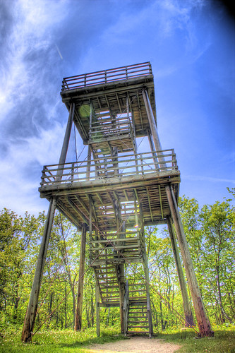
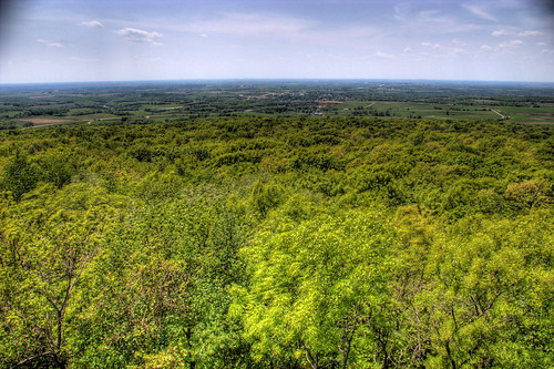
After hiking nearly an hour through dense woods at Blue Mound State Park, the trees lifted and skies widened.
Blue Mound State Park is the highest point in Southern Wisconsin. 2-billion years ago this area comprised the “roots” of an ancient mountain range and gradually, these mountains were eroded down to rolling granite plains wind, rain, ice, and inland sea's.
As Wisconsin terrain warped up and down repeatedly, extensive inland oceans alternately flowed into and retreated from the area. In the process, sand and soft limy sediments were deposited on top of the granite. The first sea covered the area more than 1 billion years ago, and the last (the Silurian Sea) about 400 million years ago.
Eons of cementation and pressure changed the sands and limy sediments into sandstone’s and limestone’s. Most of Wisconsin, Illinois, Iowa, and Minnesota once looked much the same until a series of four glaciers inched their way across the North America thousands of years ago. Massive sheets of ice peeled off hilltops and filled in valleys from Canada to Kansas, leaving a vast, flat expanse in their wake.
Due to certain geological quirks of fate, southwestern Wisconsin was bypassed and encircled by the four glaciers. The area, therefore, stands as an island of hills and valleys amid surrounding plains. The term “Driftless Area” is given to this region because it is devoid of drift or the accumulated rock and soil left by retreating glaciers.

No comments:
Post a Comment